SGS and Picterra are helping to prevent illegal logging in Liberia.
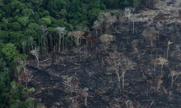
The negative effects of illegal logging are well studied, and reputable sources agree that it causes enormous damage to the environment and societies around the world. According to the EU’s official assessment:
“In economic terms illegal logging results in lost revenues and other foregone benefits. In environmental terms illegal logging is associated with deforestation, climate change and a loss of biodiversity. In social terms illegal logging can be linked to conflicts over land and resources, the disempowerment of local and indigenous communities, corruption and armed conflicts.” 1
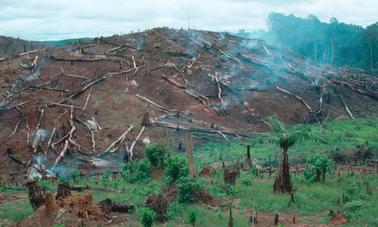
Despite the known damage caused by illegal forestry, it still exists for a variety of reasons, the main ones being:
- A desire for profit
- A local need for vital resources, primarily agricultural
- A global need for wood based products, such as paper and building materials
In fact, forests can be used to provide resources such as food and shelter via more regulated and responsible means. Additionally, while most of the world’s deforestation takes place in developing countries, this is mainly because many products that come from forests there will be sold to developed regions, such as the EU and North America.
How can satellite imagery and machine learning help?
Today, many organizations – charitable organizations as well as governments – are fighting to protect the world’s forests. Some governments have created laws mandating the sustainable harvesting of trees. However, they often do not have the resources to enforce them. Hiring patrols to watch over every acre of forest is expensive, it is impossible to install enough sensors to cover it all, and both methods are quite invasive.
Geospatial imagery via satellites, combined with machine learning makes an ideal solution. It provides a non-invasive means of identifying illegal deforestation in small areas and alerting authorities to it, so they can carefully direct their limited resources.
Satellites can be used to obtain images that cover large regions of forests, without disrupting wildlife or using massive amounts of manpower. Machine learning simplifies the process of finding areas of deforestation by simplifying the process of comparing before and after images. Data-driven techniques can be used to find problem spots across all of a country’s forests in a small amount of time.
SGS Supports the Government in Tackling Deforestation in Liberia
After many years of civil war in which the country's natural resources were plundered, Liberia resolutely committed itself to a policy of sustainable management of its resources, including its forests.
In particular, the country made a commitment to the European Union to produce and export only legal timber. Within the framework of this Voluntary Partnership Agreement (VPA), Liberia strengthened its regulatory framework for sustainable forest management and established a Legality Verification Department (LVD) within its Forest Development Authority (FDA).
The Government of Liberia mandated SGS to establish and operate the LVD for a transitional period until it could be managed by the FDA.
After five years, the LVD was fully transferred to the Government of Liberia. In recognition of its contribution to the success of the LVD, SGS was retained in the role of third party auditor of Liberia’s forestry activities.
To fulfill this role, SGS relies on a small team of local experts to monitor all logging areas in more than one million hectares of forest concessions and ensure that they comply with the logging authorizations granted by the forest authority.
Picterra Provides the Technical Expertise to Easily Identify Where Logging Activities Are Taking Place
To help manage the technological aspects of this challenging task, SGS teamed up with Picterra, a geospatial and machine learning startup based in Lausanne, Switzerland. Picterra provides the technical expertise that allows SGS to easily identify where logging activities in Liberia’s forest concessions are taking place and determine the scale and degree of compliance with regulations. SGS can then report these locations to authorities so they can perform any necessary law enforcement actions.
The process is divided into two main stages:
- The first stage consists of the collection and analysis of satellite images of the areas of interest. This technological process is carried out remotely by Picterra
- During the second stage, SGS, drawing on its practical experience in the forestry sector and its local presence, validates the detections and provides the government with alerts, reports and useful technical assistance
Stage 1 – Picterra Collects and Analyzes Satellite Images on a Continuous Basis
Preliminary work: Collect legal and geographical reference data
Liberian forest concessions are subject to annual plans which the forestry authorities use to authorize logging in georeferenced plots of 100 hectares. All felling in these plots must be declared on a monthly basis. These declarations are the basis for calculating felling taxes.
SGS has the legal and geographical information on these forests. This includes maps of production forests, management plans, the list of plots authorized for felling and the activity declarations of the logging concessionaires.
From there, Picterra’s contribution to the project can be summarized in two key steps:
Step 1: Preparing the data
Openly available satellite imagery from the Sentinel constellation is downloaded at a rate of every five days, enabling a rapid response in the field.
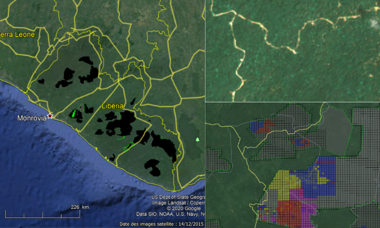
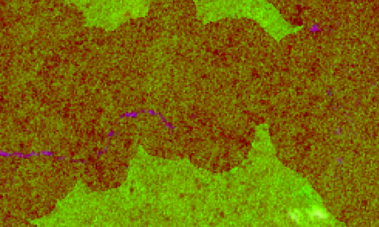
From here, images using both optical and infrared data from different dates are preprocessed together using compositing and false color techniques.
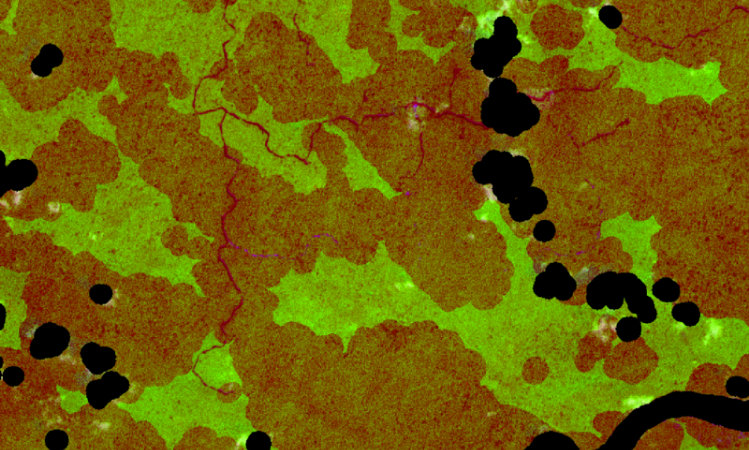
Step 2: Use machine learning to identify areas of deforestation
We use a subset of these pre-processed images to train a machine learning based detector to find areas of deforestation, accounting for variations in visual appearance and image quality. This step can be accomplished entirely on the Picterra platform. Using this trained model, we can then identify illegal logging across the rest of Liberia’s target regions using the Picterra API.
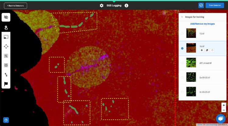
The results are then uploaded to a visualization interface specifically developed for this project, making it easy for SGS to analyze and inspect the results.
Detections are updated periodically, with machine learning being used to improve the model over time via feedback.
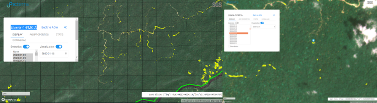
Stage 2 – SGS Provides Alerts, Reports and Technical Assistance to the Forest Authorities
We use our extensive experience in forest control and long-term presence in Liberia to enable us to analyze all logging activity found on the Picterra web platform. Experts compare detected tree felling areas with legal data and the activity declarations of the corresponding forest permit.
In case of doubt, SGS can perform verifications using paid-for higher resolution images as well as targeted field visits. The results of these verifications are integrated into the machine learning system to further improve its performance.
SGS will report any unauthorized or undeclared logging to the forest authority in the form of early warnings and periodic reports and assist the government in conducting field checks and following up on infractions.
Protecting Forests Becomes Feasible
This innovative technology enables SGS to make the timely localization of forest harvesting zones, something once thought to be virtually impossible, a feasible process. We are already obtaining tangible results, and there is no doubt that, over time, the remaining obstacles will be overcome.
Picterra and SGS will continue to improve the accuracy and efficacy of these technologies and make governments more aware of solutions to deforestation that protect natural landscapes while optimizing the benefits of sustainable forest management.